


over one hundred prints
All prints are available custom-framed or as ready-to-hang stretched canvas.
Gallery-quality prints · Independent artists · Décor to adore

” by ArtHistory")

from $ 15
” by ArtHistory")

from $ 15
” by ArtHistory, 1958")

from $ 15


from $ 15
” by ArtHistory, 1973")

from $ 15
” by ArtHistory")

from $ 15
” by ArtHistory")
from $ 15
” by ArtHistory, 1950")

from $ 15
” by ArtHistory")

from $ 15
” by ArtHistory")

from $ 15


from $ 15
” by ArtHistory, 1945")

from $ 15
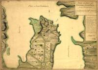
 Map (1760)” by ArtHistory")

from $ 15
” by ArtHistory, 1944")

from $ 15


from $ 15
” by ArtHistory")

from $ 15


from $ 15
” by ArtHistory")

from $ 15
” by ArtHistory")

from $ 15
” by ArtHistory")

from $ 15
” by ArtHistory, 1964")

from $ 15


from $ 15


from $ 15
” by ArtHistory")

from $ 15
” by ArtHistory, 1936")
from $ 15
” by ArtHistory, 1948")

from $ 15
” by ArtHistory, 1947")
from $ 15
” by ArtHistory")

from $ 15


from $ 15
” by ArtHistory")

from $ 15