


over one hundred prints
All prints are available custom-framed or as ready-to-hang stretched canvas.
Gallery-quality prints · Independent artists · Décor to adore


from $ 11


from $ 11
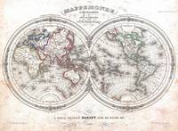
” by Ninboy")

from $ 11
” by Alleycatshirts")

from $ 11
 Alask” by Alleycatshirts")

from $ 11
 Vintage Albanian Atlas” by Alleycatshirts")

from $ 11


from $ 11
 Massachusetts, Conne” by Alleycatshirts")

from $ 11
” by Alleycatshirts")

from $ 11
 Virginia National Park” by Alleycatshirts")

from $ 11
 Vintage” by Alleycatshirts")

from $ 11
” by Alleycatshirts")

from $ 11
 US & British Caribbe” by Alleycatshirts")

from $ 11
 Kentucky Cav” by Alleycatshirts")

from $ 11
” by Alleycatshirts")

from $ 11
” by Alleycatshirts")

from $ 11
 Vintage Waladli Island Atla” by Alleycatshirts")

from $ 11
 V” by Alleycatshirts")

from $ 11
 South Ca” by Alleycatshirts")

from $ 11
 Vintage Ocean” by Alleycatshirts")

from $ 11
 Vintage NC” by Alleycatshirts")

from $ 11
 Vintage Portuguese I” by Alleycatshirts")

from $ 11
 Vintage L” by Alleycatshirts")

from $ 11
” by Alleycatshirts")

from $ 11
” by Alleycatshirts")

from $ 11


from $ 18
” by Alleycatshirts")
from $ 11
” by Alleycatshirts")

from $ 11
” by Alleycatshirts")

from $ 11
” by Alleycatshirts")

from $ 11